There are a lot of things to consider when flying your drone: weather conditions, flight path management, flying legality, drone insurance needs and more! The good thing is, there are a lot of platforms and applications available that can take some of the burden off of you! We looked around - here is our list of the top 5 you should know about:
(1) Hover
One of the simplest, yet most useful apps on the market – great for any flyer, beginner to novice. To fly you need two things: (1) a location to fly and (2) permit-table weather. Hover quickly shows you no-fly zones in your area PLUS weather conditions including: wind speed and direction, temperature and sunset/sunrise times.

For more information on Hover, click here.
(2) B4UFLY
Created by the Federal Aviation Administration (FAA), B4UFLY allows users the ability to quickly check where they can legally fly AND whether a planned route is legal. With interactive maps and filtering options, the user experience is easy to navigate.

For more information on B4UFLY, click here.
(3) Autopilot
With Autopilot, you can fly like a professional. Autopilot enables you to execute flight and camera control sequences that have previously been too difficult to perform manually. It provides new methods to move the camera – allowing for a more natural-looking cinematic shot. It is compatible with many DJI drones including: Inspire series, Mavic series, Phantom series, Spark series and Matrice series.

For more information on Autopilot, click here.
(4) Verifly
Need insurance on-demand? Verifly is a go-to option that offers on-demand drone insurance – starting at $10 per hour. The process is pretty simple – you tell Verifly where you plan to fly and they provide an estimate for drone insurance. Verifly provides immediate proof of insurance.

For more information on Verifly, click here.
(5) Sun Surveyor
For the sunset enthusiast – this app is for you! Sun Surveyor is your personal guide to the sun and moon. Plan your dramatic sunset photos and/or videos with ease. Get all the details – golden hours and blue hour times, moon phases, milky way center visibility and more. Plan the perfect shot in the perfect light.

For more information on Sun Surveyor, click here.
BONUS professional/commercial platforms:
(6) DroneDeploy
One of the top mapping and modeling solutions on the market today – DroneDeploy is a full-featured aerial information platform (plus mobile app) that enables drone operations at scale. DroneDeploy is customized for all business sizes, from small to large, and is compatible with numerous industries including: construction, surveying, agriculture and mining.
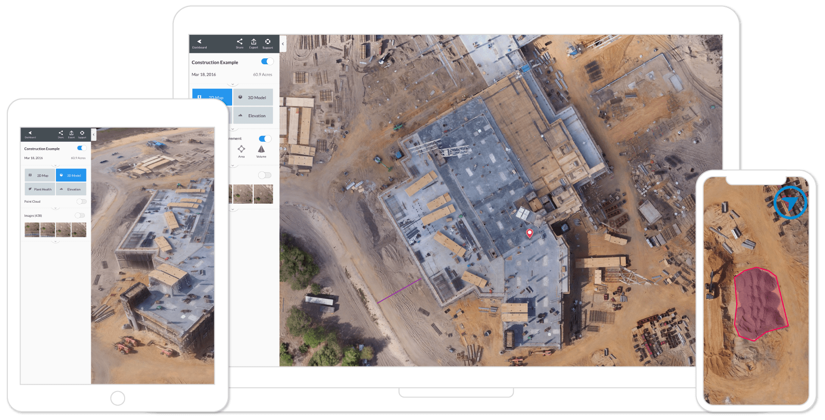
For more information on Drone Deploy, click here.
(7) Skyward
Skyward is one of the most popular commercial drone management platforms on the market today. Skyward can help you gain comprehensive oversight by planning flight operations, tracking and analyzing flight data, accessing controlled airspace and managing drone teams.

For more information on Skyward, click here.